
ISRO Plans Major Boost to Navigation Network with Three Satellite Launches by 2026
India’s space program is set to enter a new phase of technological expansion as the Indian Space Research Organisation (ISRO) gears up to launch three new navigation satellites by 2026. The move aims to significantly enhance the capabilities of the country’s indigenous navigation system — the Indian Regional Navigation Satellite System (IRNSS), also known as NavIC.
With growing reliance on satellite-based navigation in areas ranging from defense and disaster management to transportation and smartphone usage, these new satellites are poised to fill critical coverage gaps, increase signal accuracy, and add robustness to India’s navigation architecture. This step marks another milestone in India’s long-term goal to develop self-reliant infrastructure in critical sectors, especially in space and telecommunications.
What Is NavIC?
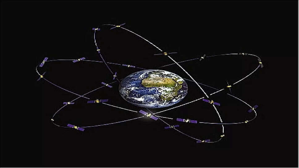
NavIC (Navigation with Indian Constellation) is India’s home-grown satellite navigation system designed to provide accurate position information to users in India and up to 1,500 kilometers beyond its borders. It is often compared to other global systems like the United States’ GPS, Russia’s GLONASS, the European Union’s Galileo, and China’s BeiDou.
Currently, NavIC comprises seven satellites, providing regional coverage over the Indian subcontinent. However, to enhance the reliability, signal strength, and user availability — especially in urban areas or during satellite maintenance periods — ISRO has decided to add three more satellites to the constellation. These launches, expected to be completed by 2026, will strengthen India’s regional navigation framework and elevate its status in the field of space technology.
Why New Satellites Are Needed
Although the existing NavIC satellites have performed well, several factors prompted the decision to expand the constellation. Some of the original satellites are nearing the end of their operational lifespan. Others have experienced issues related to onboard atomic clocks, which are vital for precise timekeeping — the core function in satellite navigation.
Adding new satellites will not only replace ageing ones but also add redundancy and resilience to the system. Furthermore, as India’s economic, defense, and digital infrastructure increasingly depend on precise timing and location data, it becomes crucial to ensure uninterrupted services.
The enhanced constellation will allow NavIC signals to penetrate better through buildings and dense terrain, making it more effective for urban mobility solutions, disaster response systems, aviation, agriculture, fleet management, and location-based services.
Technical Upgrades Expected
ISRO plans to incorporate a series of technical improvements in the new navigation satellites. These may include:
-
Dual-frequency operation: Currently, NavIC satellites broadcast in L5 and S-band frequencies. The upcoming satellites are expected to be equipped to broadcast in L1 frequency as well — the same band used by most international GPS receivers. This will make NavIC signals compatible with more commercial smartphones and navigation devices globally.
-
Improved atomic clocks: One of the key elements in navigation satellites is their atomic clocks, which maintain the precision of time signals. The upcoming satellites will likely feature next-generation Rubidium atomic clocks that offer higher stability and are more resistant to malfunction.
-
Stronger signal footprint: The new satellites will be designed to offer wider and stronger coverage, ensuring that signals remain consistent even in challenging environments like mountainous regions or deep urban zones.
These technological enhancements will make NavIC more competitive and suitable for both military and civilian use cases, potentially positioning it as a viable alternative to foreign satellite navigation systems.
Strategic and Geopolitical Significance
India's push for a stronger navigation system is not just a technological necessity but also a strategic imperative. During critical national operations — such as military deployments or disaster management — dependence on foreign systems like the U.S.-owned GPS may pose limitations or vulnerabilities, especially during conflict or global crises.
With the upcoming launches, India aims to ensure autonomy and sovereignty in navigation capabilities. A more robust NavIC system can also serve as a platform for allied regional countries looking for alternatives to GPS. India's ability to offer services to neighboring nations could strengthen its regional influence and technological leadership in South Asia.
Furthermore, securing a reliable navigation system aligns with the government’s broader "Atmanirbhar Bharat" (self-reliant India) vision, where home-grown technology is prioritized across key sectors.
Applications and Industry Impact
With the launch of these new satellites, NavIC’s applications are expected to expand across several domains:
-
Transportation and Logistics: Real-time vehicle tracking, route optimization, and fleet management will become more efficient. It will also aid in implementing tolling systems, railway safety, and public transport management.
-
Aviation and Maritime: Aircraft navigation, route tracking, and port operations will benefit from more precise data, especially in adverse weather or remote coastal zones.
-
Agriculture: Farmers can use NavIC-based apps for precision farming, tracking rainfall patterns, soil conditions, and optimizing the use of fertilizers and irrigation.
-
Telecommunications: Accurate time stamps provided by navigation satellites are essential for network synchronization, especially in 5G and future internet-of-things (IoT) ecosystems.
-
Disaster Response: During floods, cyclones, or earthquakes, real-time location data will assist in rescue operations, evacuation planning, and coordination of relief efforts.
Moreover, with the integration of NavIC into consumer smartphones — already started by some brands — Indian users will gradually shift from using foreign systems to a more localized one, thus ensuring data sovereignty and reduced dependency.
The Road to 2026: Timeline and Launch Vehicles
The three new satellites are currently in various stages of design and fabrication at ISRO’s satellite centers. While exact launch dates haven’t been confirmed publicly, officials have indicated that they will be spaced over the next two years, with the final one likely launched before the end of 2026.
It is expected that the launches will be carried out using ISRO’s trusted PSLV (Polar Satellite Launch Vehicle), which has a successful track record in deploying navigation satellites into geostationary and geosynchronous orbits. However, the newer GSLV (Geosynchronous Satellite Launch Vehicle) may also be considered, depending on satellite mass and orbital requirements.
Once in orbit, these satellites will undergo a series of validation checks before being integrated into the existing NavIC framework. Ground stations and monitoring infrastructure are also being upgraded to manage and control the enhanced system.
The planned launch of three new navigation satellites by 2026 marks a significant leap forward in India’s space ambitions. As global navigation systems become increasingly entangled with digital economies, national security, and civilian infrastructure, India is making a decisive investment in its technological independence.
Through these new additions, NavIC will not only become more reliable and versatile but also better positioned to serve both domestic and regional needs. Whether it’s guiding a taxi through a bustling city or enabling time-critical military coordination, India’s space-based navigation system is ready to chart a sharper, more accurate future.